
Our Geography class visited IWMI (International Water Management Institute) in April for a brief talk on water management, which was a unit we were studying at the time. The office of IWMI is close to school and is the head office of this international institute. It was interesting to learn about how the topic of water management is addressed on a larger scale. I was immediately interested in what was being done here, which resulted in the idea of doing an internship at IWMI. So, in the last few weeks of school of the second semester, Rashmi and I organised a three-week internship in the GIS (Geographic Information Systems) department.
IWMI is an international institute that has projects in many developing countries especially in Africa and Asia concerning water security and management. These include primarily agriculture and irrigation and other areas involving water such as energy production. Several regional offices are located in both Africa and Asia, but this, being the head office, oversees all work and is additionally responsible for South Asian projects, making this an exciting opportunity learn about their work. We chose to be based in the GIS department as this was were the person, David Wiberg, who gave the presentation earlier for our Geography class works, and because we find GIS very interesting and useful as we can use it for other school projects as well.
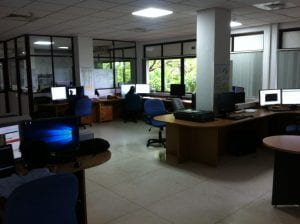
The GIS department at IWMI where we worked.
Companies often give some work to keep the interns busy as they don’t trust them with important work, but what was great about this internship was that we actually did necessary work for the institute and contributed to their projects. The three weeks we were there were structured the following way. The first week we worked on gathering all the data that the GIS department uses and more data that could be used, as they did not have that before and needed an overview of what data is available. This was very tedious as we spent the first few days searching for all datasets we could find and had to find corresponding information such as the date, spatial coverage, temporal coverage and evaluation of the datasets.

Analyzing a dataset on global forest cover change. Photo credits: Rashmi Bopitiya
The second a most of the third week we did some spatial work for a project IWMI is doing in northern Sri Lanka. This consisted of editing land cover data on ArcGIS and merging all separate hydrology (lakes, dams and rivers) and agricultural layers together to form one general layer of each. This was put onto Google Earth Engine where we compared the data to satellite imagery to see how accurate it was. The data was made by using an algorithm that calculates land cover from aerial imagery, but there can be inaccuracies, and that was also the case here. So, Rashmi and I spent most of the time mapping agricultural areas that were not covered by the original data. On the final two days we revisited the collection of datasets we made in the beginning and added some more.

To create a single agricultural layer, features that represent agricultural areas were extracted from data on land cover in northern Sri Lanka and then merged with other agricultural features.
Each work day started at 8:00 and ended at 16:30. We took a few breaks in between, including a roughly 30-minute lunch break, but the work was very tiring and we were tired after work every day. The atmosphere at the workplace was very relaxed and it was fun playing table tennis at lunchtime in the canteen.
The internship overall was a great opportunity to for me to get an experience of how the workplace is like in terms of workload and atmosphere. I noticed especially how independent one is expected to – we checked in with the colleagues around once a week but the rest of the time one just has to work independently.