One of my favourite things has always been travelling to different countries, and I one day strive to go to more than 100 countries around the world. Given the COVID situation, it is not something I have been able to do for nearly two years, and is something that I am looking forward to doing again.
Last year, I was scrolling the web when I came across a website called Trip Happy, which allowed you to map out travel routes, and select transport methods between the destinations. I spent a few hours on it, and ended up creating a massive tourism map of Europe. There were over 120 cities and towns in over 25 European Countries on the map. It covered almost the entirety of Europe, from Norway and Sweden, to Croatia and Slovenia.
The chances of me over going on that entire trip are slim to none, but the idea was that it could be broken down into smaller trips, for example Eastern Europe. When I would see new destinations or places that I wanted to go to on Social Media, I would always go and add them to this map. Recently however, I went back to add a Croatian town to the map, when I discovered that the website had been taken down. I was quite frustrated as I had invested a lot of time into the specific map.
I decided to start over and make another map. The first thing I had to was to find a website, and encountered a problem as many of the websites required subscriptions or fees to sign up. I eventually found a Website called ‘Wanderlog.’ It is a much better website than the previous one, as I was able to map the trip and select transport and select accommodation. Not only that, but the website would give suggested activities, and divide up the trip into a perfect itinerary depending on how long you wanted the trip to be.
LO #4: Show commitment to and perseverance in CAS experiences.
Iberian Peninsula
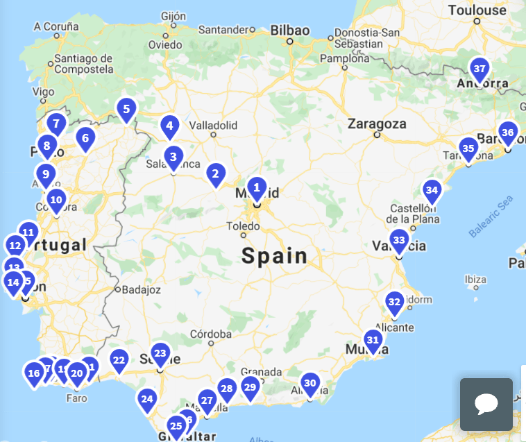
I decided to start by firstly mapping out all of the cities. I started with Portugal, as it is somewhere that my mum and I have always wanted to visit. I was able to ask my friend and former OSC student George, who lives in Portugal, for some under the radar destinations that he would recommend. He suggested Nazaré and Peniche, two coastal Portuguese cities situated in between Porto and Lisbon, famous for incredible surf. In fact, Praia do Norte in Nazare is known to have the tallest surfable waves in the world. He also suggested Coimbra, a city with beautiful architecture.
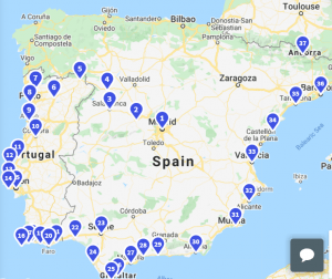
I then moved the trip along by crossing the border into Spain, starting in Huelva on the South West of the nation. I then discovered that the website can also suggest places to travel to, so I used that feature to discover Tarifa, a beautiful town which happens to be the Southernmost point of Spain, which lies just to the West of Gibraltar. I then made my way along the Spanish Coast, through Malaga, Almeria, Alicante, Valencia, before finally reaching Barcelona. The last destination in the Iberian Peninsula was Andorra, sandwiched between France and Spain. It is mostly known for skiing. Upon looking at the map so far, I decided to reshuffle the order, and have Madrid, the Spanish capital, as the first city of the trip. This would allow travel West into Portugal, and then around the South and East coast of Spain. Below is the map for the Iberian Peninsula at the moment.

I will continue doing this same process for the entirety of Europe (and some other continents/regions too), and after mapping the route, the next step will be to look at itinerary. This is something that I can do in the future when I (hopefully) actually go on one of the trips within Europe. My next step is to go from Andorra, where I ended here, through the South of France and down Italy.
I felt as though this is an activity that will help me in the future. While this was a very time consuming process, I was able to gain new understanding. For example, learning about different cities, and their histories. Overall, I was able to learn and develop the skill of mapping logically, and constructing a trip that makes sense. It is one thing to have a series of places to visit, but another all together to be able to construct a logical and efficient route to visit these places.
LO #2: Demonstrate that challenges have been undertaken, developing new skills in the process.
